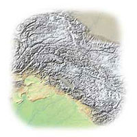
Services

Cartographic Maps

CARTOGRAPHY
Map Illustrations offers a wide range of cartographic services that encompasses most mapping styles and themes. Digitally created and personally designed to meet your needs, our maps can add value to your publication. All our maps are designed not only to please the eye but are cartographically correct in every detail and, where possible, are created from public domain data. All maps are copyright free with the exception of third party data license agreements.


Digital Terrain Maps

DIGITAL TERRAIN MODELING
Map Illustrations also offers a 3D terrain modeling service for the engineering and book publishing industries. We can take the standard overhead view of shaded relief maps and generate realistic 3D views of real world places. Our software can "cover" the terrain with forests, roads, lakes, rivers and can even have satellite imagery draped over the model for land cover realization and analysis. All image files are created in PhotoShop and can be saved any format.


Shaded Relief Maps

SHADED RELIEF
Map Illustrations can compliment your base artwork with a wide range of shaded mountain relief images. All images can be projected and scaled to your base artwork for quick and easy placement. Coloration can be adjusted to any number of palettes, lighting adjusted to any angle, and additional artwork or satellite imagery can be overlaid onto the shaded relief image. All image files are created in PhotoShop and can be saved any format with TIFF, BMP, JPEG and GIF being the most requested formats.

TOP


Copyright Map Illustrations